Chiricahua National Park in southeastern Arizona is known for its dramatic rock formations, scenic viewpoints, and hiking trails winding through a landscape shaped by ancient volcanic activity. I visited the park on a day trip from Tucson in April, hiking to the summit of Sugarloaf Mountain and stopping at Massai Point before heading back.
During my visit, I explored the park’s otherworldly rock formations, hiked to the top of Sugarloaf Mountain, and stopped at Massai Point to take in the views. Here’s how my day unfolded.
Chiricahua becomes a National Park
Chiricahua was first designated a National Monument on April 18, 1924, before officially becoming Chiricahua National Park on October 20, 2026.
Chiricahua recently became the 64th US national park and I definitely think the designation is well deserved. At the same time, I imagine it will remain one of the less-visited national parks because of its remote location. It is simply far from everything, and unless you are staying nearby or passing through southeastern Arizona, getting there requires quite a bit of driving.
The new designation could bring more visitors and have a positive economic impact on small towns such as Willcox and the surrounding communities. However, I also hope that increased recognition will not come at the expense of what makes Chiricahua so special.
Personally, one of the things I enjoyed most about visiting was the feeling of being somewhere remote and wild, far away from the crowds and more developed tourist destinations. I would love to see the local communities benefit from the park’s new status, while Chiricahua retains its peaceful atmosphere and sense of isolation. Finding that balance will be important to preserving the experience that makes this place so unique.
Planning a day trip to Chiricahua from Tucson
Distance and driving times to Chiricahua
| City | Distance | Time |
|---|---|---|
| Willcox, AZ | 36 miles (58 km) | 45 min |
| Tucson, AZ | 120 miles (193 km) | 2 hours |
| Las Cruces, NM | 190 miles (305 km) | 3 hours |
| Phoenix, AZ | 230 miles (370 km) | 3 hr 45 min |
| El Paso, TX | 240 miles (386 km) | 3 hr 45 min |
As I was staying in Tucson for a week in April, I was looking for an interesting day trip nearby. I had already visited Saguaro National Park and Mount Lemmon, so I wanted to find something different. That’s when I came across Chiricahua National Monument, which has now become a 64th National Park.
At first, it seemed pretty far from Tucson because it takes more than two hours to get there. But even the name Chiricahua sounded intriguing, so I decided to look into it a little more. The name Chiricahua comes from the Opata language and means “wild turkey” or “range of wild turkeys.” The more I read about the place, the more interesting it seemed, and eventually, I decided to go and see it for myself.
The drive from Tucson to Chiricahua National Park
On my way from Tucson to Chiricahua, I stopped in the small, rustic Western town of Willcox to pick up a sandwich and a few snacks at a grocery store.
To my surprise, I learned that the movie Red Rock West had been filmed there. I had seen the movie many years ago and really liked it. After looking around the town, I could understand why they had chosen Willcox as one of the filming locations. The whole place had the feel of an old Western movie set, with its rustic buildings and quiet streets.
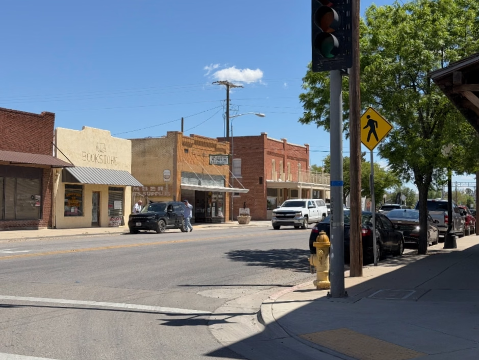
After getting a sandwich, water bottles and some protein bars, I got back on the road. My navigation showed about 45 minutes left to Chiricahua.
Once I left Willcox, the traffic became lighter and lighter. During the last few dozen miles, there were barely any cars on the road. In fact, I don’t remember passing a single car during the last 20 miles. I remember thinking to myself, Wow, this place must be really remote. Dust added to the typical Old West atmosphere.

When I finally reached the park boundaries, however, I started seeing a few more cars and motorcycles parked along the road. I was actually kind of glad to see them. At least it was a good sign that there would be other people around.
At the Visitor Center
When I arrived at the main visitor center, I saw a few parked cars and families having picnics. I took a quick look around the visitor center and then sat down on a bench outside to eat some of the snacks I had bought in Willcox.

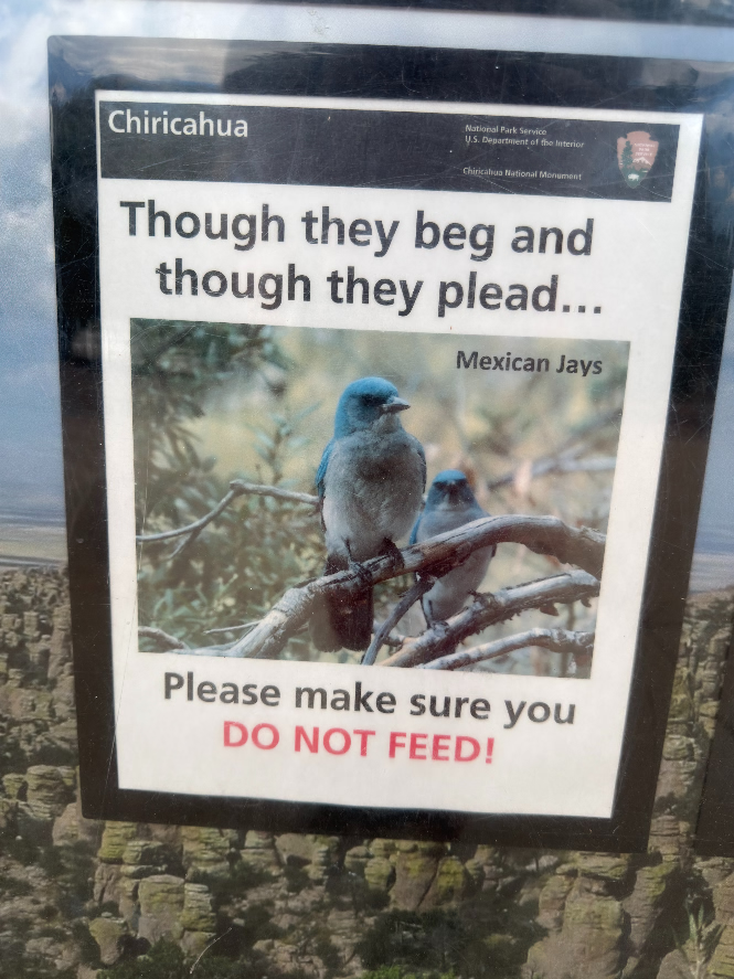
As I was sitting there, I noticed a beautiful blue bird I had never seen before. I later learned that it was a Mexican Jay. Apparently, it was quite used to people and seemed to be hoping I would share some of my snacks with it. But being a responsible visitor, I knew that feeding wildlife is prohibited, so I didn’t give it anything. Instead, I just sat there and admired its beautiful blue feathers.

Hiking Sugarloaf Mountain
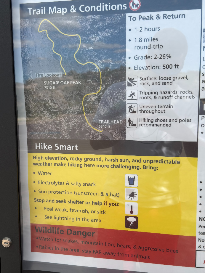
The Sugarloaf Mountain Trail is a moderate 1.8-mile (2.9 km) round-trip hike with approximately 500 feet (152 m) of elevation gain. Allow 1–2 hours to reach the summit at 7,310 feet (2,228 m) and enjoy panoramic views of Chiricahua’s dramatic rock formations.
I pulled out the map I had picked up at the visitor center and started looking for a hike that would give me a good overlook of the park and the surrounding landscape. Looking at the map, I came across Sugarloaf Mountain which didn’t seem too difficult, so I decided to drive to the trailhead. When I arrived, there were no other cars in the parking lot. I thought that perhaps this was not a popular hike but looking at the mountain, I knew one would get fantastic views of Chiricahua. There is a fire lookout at the very top too.

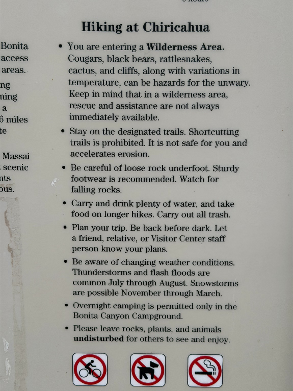
Right at the beginning, I noticed a warning sign mentioning aggressive bees, rabid animals, snakes and mountain lions in the area. That definitely made me feel a little unsettled because in case of emergency, there is very limited cell phone reception.
Looking up at the mountain from the parking lot, I started having second thoughts about whether I really wanted to do the hike. Something was telling me to turn around. I kept wondering if it was a good idea to head up there when there is nobody else. Especially after reading the warning signs.
Eventually, though, I decided to take the hike and looking back, this was a great decision.
I later discovered online that dozens of mountain lions had been recorded in the park, and there had even been rare sightings of American jaguars in Chiricahua Mountains. I had no idea jaguars could be found this far north. This was really amazing to learn. Apparently, they come from Mexico and occasionally make their way into Arizona.

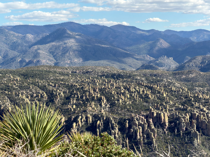
As I climbed higher, my initial fear gradually gave way to excitement. Before long, I started getting incredible views over the surrounding valley. I couldn’t get enough of those towering rock formations all around. Unbelievable, I thought.
These rock formations were created by a massive volcanic eruption about 27 million years ago. Thick layers of volcanic ash hardened into rock, which later cracked as it cooled. Over millions of years, rain, wind, and freezing water eroded the softer rock, leaving behind the tall, narrow rock towers seen today.

The weather couldn’t have been better. It was partly cloudy but mostly sunny, with crisp, high contrast light that made the landscape look even more dramatic.
On the way up, I came across this lizard trying to absorb some sunlight. It’s called a Spiny Lizard and one interesting fact is they can change their body color shade based on the temperature. They will turn darker to absorb more heat from the sun when basking and they will turn lighter to reflect sunlight and keep cool. I suppose this one was trying to get warm.

When I reached the summit, I was rewarded with 360° views of the surrounding landscape, with visibility extending for tens, if not a hundred, of miles. Sugarloaf Mountain is actually the highest point in Chiricahua National Park, at 7,310 ft (2,228 m).


I’m pretty sure I could see all the way to Mexico and New Mexico from the summit. There was a fire lookout at the very top, and I sat right next to it, enjoyed the view, and ate some of the snacks I had brought with me.
Then it was time to head back down. On the way, I came across two other hikers, which made me feel a little more comfortable. At least I knew I wasn’t the only person out there.
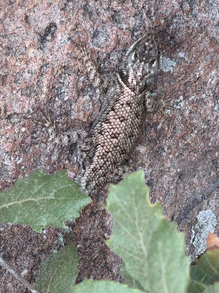
On the way down, I came across another Spiny Lizard resting on the bark of a tree in the shade. This one looked a little lighter than the first one I had seen. I suppose it had already warmed up enough.
Massai Point: An Easy Walk with Spectacular Views
After the hike to Sugarloaf Mountain, I made one more stop before leaving the park: Massai Point. There’s a short and easy trail there that offers spectacular views of the surrounding rock formations and valleys.
The Massai Point Nature Trail is an easy, 0.5-mile (0.8 km) loop with minimal elevation gain. Allow about 30 minutes to explore the trail at 6,870 feet (2,094 m) and enjoy panoramic views of Chiricahua’s spectacular rock pinnacles.
One of the interesting views from the Massai Point is Cochise Head Peak, named after the famous leader of the Chiricahua Apache who once lived in these mountains. It looks like he’s lying down, and you’re looking at him from his left side. This peak reaches 8,113 feet (2,473 m), rising just beyond the northeastern boundary of Chiricahua National Park.

Massai Point seemed much more touristy than Sugarloaf Mountain. I saw people having a picnic and quite a few other visitors. There was even a short wheelchair accessible trail leading to an indoor exhibit, which I thought was a really thoughtful touch and showed consideration for visitors with disabilities.
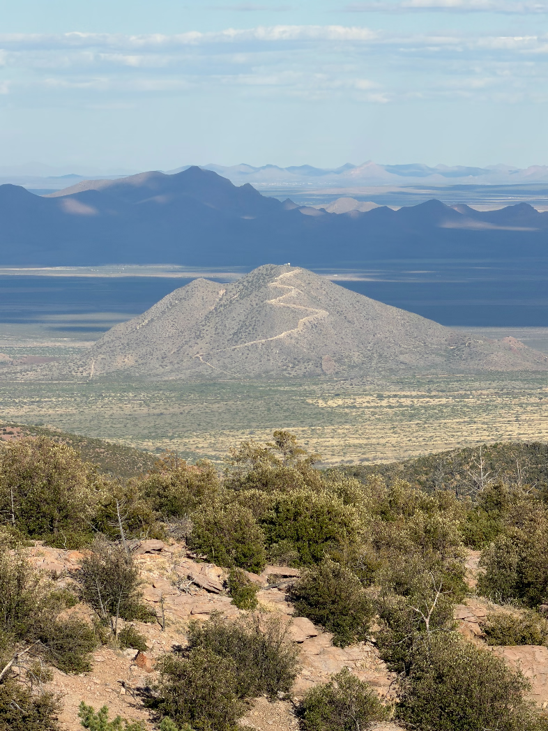
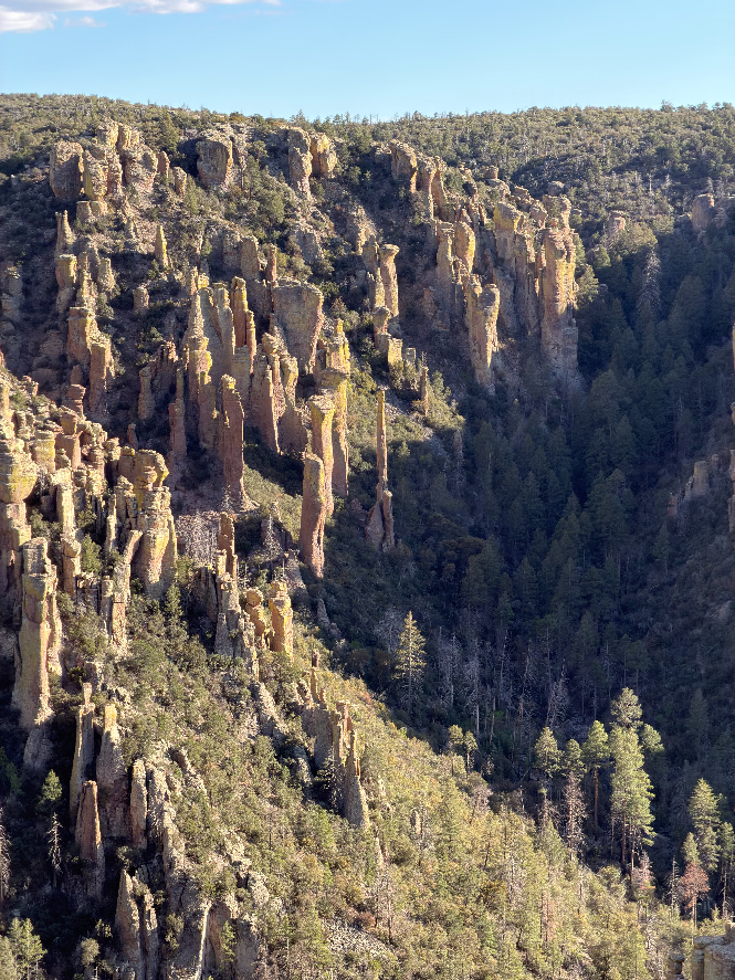
By now, sunset was approaching, so it was time to leave the park and head back to Tucson. But the adventure wasn’t over just yet. Watching the landscape from the car as I drove away was almost as rewarding as the hikes themselves. What a drive.
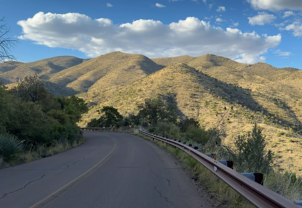
After passing through Willcox, I merged onto the highway, and the scenery gradually became less interesting. Eventually, I arrived back in Tucson after dark, and that was the end of the trip.
Hiking Trails in Chiricahua National Park
| Name | Distance | Time | Difficulty |
|---|---|---|---|
| Bonita Creek Loop | 0.2 miles (0.3 km) | 15 – 20 min | easy |
| Massai Point Trail | 0.5 miles (0.8 km) | 30 min | easy |
| Echo Canyon Grottoes | 1.2 miles (1.9 km) | 30 – 60 min | easy |
| Sugarloaf Mountain | 1.8 miles (2.9 km) | 1 – 2 hours | moderate |
| Echo Canyon Loop | 3.3 miles (5.3 km) | 2 – 4 hours | moderate |
| Natural Bridge Trail | 4.7 miles (7.6 km) | 3 – 4 hours | moderate |
| Inspiration Point | 5.4 miles (8.7 km) | 3 – 4 hours | strenuous |
| Heart of Rocks Loop | 7.4 miles (11.9 km) | 4 – 6 hours | strenuous |
| The Big Loop | 9.5 miles (15.3 km) | 4 -7 hours | strenuous |
* Distances refer to the complete hike, either loop or round trip.
Where to stay near Chiricahua National Park
If you’d rather stay in a town, Willcox is the closest option to Chiricahua National Monument. It’s a small town, but it has all you need: a handful of hotels, restaurants and groceries, and the drive to the park takes about 45 minutes. If you want to see a lot more and don’t mind being two hours from the park, Tucson is a good base. You get a much bigger choice of hotels and food, and there’s plenty to do in the city and nearby.
A Few Things to Consider Bringing
| Comfortable Hiking Shoes | Get reliable grip, comfort, and stability on Chiricahua’s rocky trails. |
| Good Quality SPF | Protect your skin from intense Arizona UV rays and reapply every two hours during outdoor activities. |
| Binoculars | Spot wildlife, observe birds, and enjoy distant views of Chiricahua’s unique rock formations. |
| Powerbank | Keep your phone and camera charged throughout your hiking adventures. |
| SOS emergency communicator | Stay connected and call for emergency help in remote areas without cell service. |
| GPS Outdoor Watches | Track your hikes, monitor elevation, and navigate trails with reliable GPS and long battery life. |
| Hiking Poles | Improve stability, reduce strain on your knees, and navigate rocky trails with greater confidence. |
Disclosure: As an Amazon Associate I earn from qualifying purchases.
Is Chiricahua National Park worth visiting?
I’m glad I came across Chiricahua while researching places to visit during my stay in Tucson, and I would definitely recommend visiting this new national park. Whether you’re an experienced hiker or simply looking to enjoy the scenery, Chiricahua has something to offer everyone. Even driving through the park and stopping at its viewpoints provides spectacular views of its unique rock formations.
There are also plenty of short, easy hikes suitable for visitors of all fitness levels. Since I only had one day, I personally chose to hike Sugarloaf Mountain and Massai Point, and both places were worth visiting.
If you’re planning a visit to Chiricahua National Park, bring comfortable hiking shoes, plenty of water, sunscreen, and a hat. Don’t forget that signal is very limited so I strongly advise downloading offline maps before you arrive.